


Լրահոս
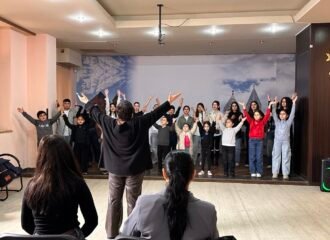
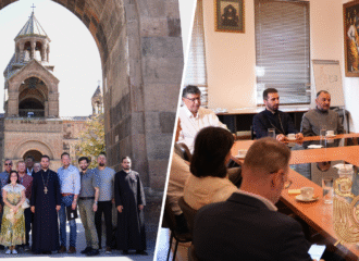
 Ավարտվեց «Դրախտի ընտանիք» ծրագրի հերթական փուլը
26.05.2026
See more ›
Ավարտվեց «Դրախտի ընտանիք» ծրագրի հերթական փուլը
26.05.2026
See more ›
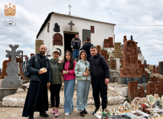
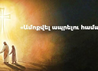
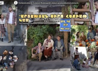
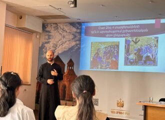
 «Արցախյան հրաշապատումներ»․ հավատի և հրաշքների վկայություններ
02.05.2026
See more ›
«Արցախյան հրաշապատումներ»․ հավատի և հրաշքների վկայություններ
02.05.2026
See more ›
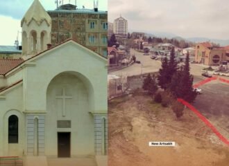
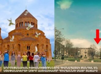 Սուրբ Աստվածածնի եկեղեցու ավերումը՝ ցավալի ազդակ Արցախից
23.04.2026
See more ›
Սուրբ Աստվածածնի եկեղեցու ավերումը՝ ցավալի ազդակ Արցախից
23.04.2026
See more ›
 Սուրբ Հակոբ եկեղեցին հիմնահատակ ավերվել է
12.04.2026
See more ›
Սուրբ Հակոբ եկեղեցին հիմնահատակ ավերվել է
12.04.2026
See more ›
 Սուրբ Զատիկ, 2026
04.04.2026
See more ›
Սուրբ Զատիկ, 2026
04.04.2026
See more ›
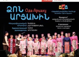
 «Արցախի բալիկներ» համույթ. արցախյան մշակույթը կենդանի է
29.03.2026
See more ›
«Արցախի բալիկներ» համույթ. արցախյան մշակույթը կենդանի է
29.03.2026
See more ›
 Հոգևոր-հոգեբանական աջակցություն բռնի տեղահանված արցախցիներին
26.03.2026
See more ›
Հոգևոր-հոգեբանական աջակցություն բռնի տեղահանված արցախցիներին
26.03.2026
See more ›
 Միացեք Արցախի մանուկներին
21.03.2026
See more ›
Միացեք Արցախի մանուկներին
21.03.2026
See more ›
 Երևանում կրկին կայանալու է «Արցախի բալիկներ» վերածնված համույթի համերգը
13.03.2026
See more ›
Երևանում կրկին կայանալու է «Արցախի բալիկներ» վերածնված համույթի համերգը
13.03.2026
See more ›
 «Դրախտի ընտանիք» ծրագրի 3-րդ փուլ. նոր հնարավորություններ արցախցի նորապսակներին
08.03.2026
See more ›
«Դրախտի ընտանիք» ծրագրի 3-րդ փուլ. նոր հնարավորություններ արցախցի նորապսակներին
08.03.2026
See more ›
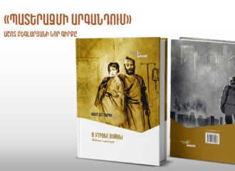 Մոսկվայում լույս է տեսել արցախցի գրող Աշոտ Բեգլարյանի հերթական գիրքը
27.02.2026
See more ›
Մոսկվայում լույս է տեսել արցախցի գրող Աշոտ Բեգլարյանի հերթական գիրքը
27.02.2026
See more ›
 Արցախի թեմի առաջնորդի նամակը ԱՄՆ փոխնախագահին
06.02.2026
See more ›
Արցախի թեմի առաջնորդի նամակը ԱՄՆ փոխնախագահին
06.02.2026
See more ›
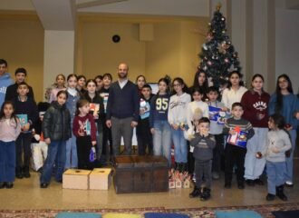 Սուրբ Ծննդյան միջոցառում «Լույս Արցախի մանուկներին» ծրագրի սաների համար
14.01.2026
See more ›
Սուրբ Ծննդյան միջոցառում «Լույս Արցախի մանուկներին» ծրագրի սաների համար
14.01.2026
See more ›
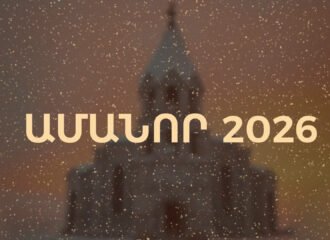 Ամանոր 2026
31.12.2025
See more ›
Ամանոր 2026
31.12.2025
See more ›
 Վրթանես եպս. Աբրահամյանի պարզաբանումը նոյեմբերի 28-ի հանդիպման վերաբերյալ
29.11.2025
See more ›
Վրթանես եպս. Աբրահամյանի պարզաբանումը նոյեմբերի 28-ի հանդիպման վերաբերյալ
29.11.2025
See more ›
 Կատարո վանքի պատմությունը
29.11.2025
See more ›
Կատարո վանքի պատմությունը
29.11.2025
See more ›
 Թող կատաղի հարձակումը մեզ վրա վարանումի առիթ չդառնա. վարչապետի կոչին միացած եպիսկոպոսների հայտարարությունը
29.11.2025
See more ›
Թող կատաղի հարձակումը մեզ վրա վարանումի առիթ չդառնա. վարչապետի կոչին միացած եպիսկոպոսների հայտարարությունը
29.11.2025
See more ›
 Արցախի մշակույթն ապրում է «Դիալոգ»-ի աջակցությամբ և տունդարձի հավատով
21.11.2025
See more ›
Արցախի մշակույթն ապրում է «Դիալոգ»-ի աջակցությամբ և տունդարձի հավատով
21.11.2025
See more ›
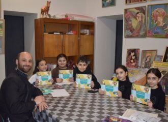
 «Դրախտի ընտանիք» ծրագիր․ Անվճար վարսահարդարման դասընթացներ
19.11.2025
See more ›
«Դրախտի ընտանիք» ծրագիր․ Անվճար վարսահարդարման դասընթացներ
19.11.2025
See more ›
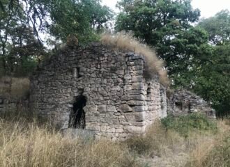 Բովուրխանի վանքը
17.11.2025
See more ›
Բովուրխանի վանքը
17.11.2025
See more ›
 Արցախի մայր թատրոնի վերածնունդը նոյեմբերի 12-ին
01.11.2025
See more ›
Արցախի մայր թատրոնի վերածնունդը նոյեմբերի 12-ին
01.11.2025
See more ›
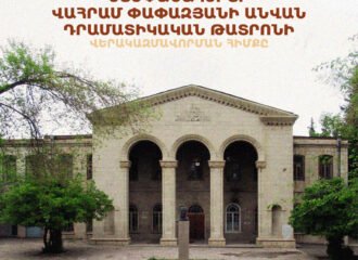 Ստեփանակերտի Փափազյանի թատրոնը վերածնվում է Երևանում
28.10.2025
See more ›
Ստեփանակերտի Փափազյանի թատրոնը վերածնվում է Երևանում
28.10.2025
See more ›
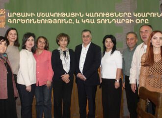
 ՀՕՄ 115-ամյակի միջոցառումներ․ արցախցի 10 ընտանիք ստացան բնակարան
24.10.2025
See more ›
ՀՕՄ 115-ամյակի միջոցառումներ․ արցախցի 10 ընտանիք ստացան բնակարան
24.10.2025
See more ›
 «Դրախտի ընտանիք». նոր հնարավորություններ նորապսակների համար
22.10.2025
See more ›
«Դրախտի ընտանիք». նոր հնարավորություններ նորապսակների համար
22.10.2025
See more ›
 Նորագյուղի պատմությունը
21.10.2025
See more ›
Նորագյուղի պատմությունը
21.10.2025
See more ›
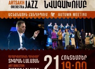 «Աշնանային հանդիպում». «Արցախ» ջազ-նվագախմբի հերթական համերգը
15.10.2025
See more ›
«Աշնանային հանդիպում». «Արցախ» ջազ-նվագախմբի հերթական համերգը
15.10.2025
See more ›
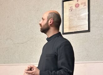
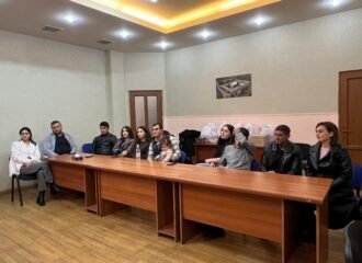
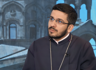 Կանչված ենք ծառայելու․ Հանդիպում Հայր Ռուբենի հետ
08.10.2025
See more ›
Կանչված ենք ծառայելու․ Հանդիպում Հայր Ռուբենի հետ
08.10.2025
See more ›
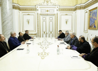
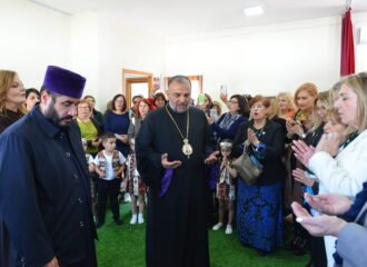
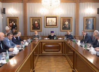 Ամենայն Հայոց Կաթողիկոսն ընդունեց ԱՀ պետական այրերին
08.10.2025
See more ›
Ամենայն Հայոց Կաթողիկոսն ընդունեց ԱՀ պետական այրերին
08.10.2025
See more ›
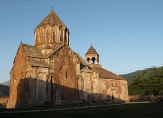 Gandzasar
04.10.2025
See more ›
Gandzasar
04.10.2025
See more ›
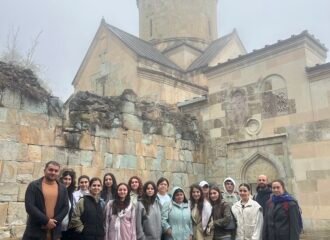 Ուխտագնացություն. Արցախի երիտասարդները Վարագավանքում
01.10.2025
See more ›
Ուխտագնացություն. Արցախի երիտասարդները Վարագավանքում
01.10.2025
See more ›
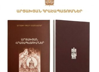
 «Արցախյան հրաշապատումներ» գրքի շնորհանդես
30.09.2025
See more ›
«Արցախյան հրաշապատումներ» գրքի շնորհանդես
30.09.2025
See more ›
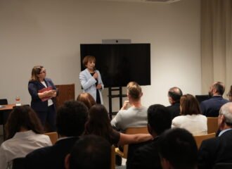
 Կարևոր հանդիպումներից. Արցախն ուշադրության կենտրոնում
26.09.2025
See more ›
Կարևոր հանդիպումներից. Արցախն ուշադրության կենտրոնում
26.09.2025
See more ›